Navigation and communication are two essential survival skills — the first is necessary to travel safely from A to B without becoming hopelessly lost, the second is critical for any group or collaborative survival effort.
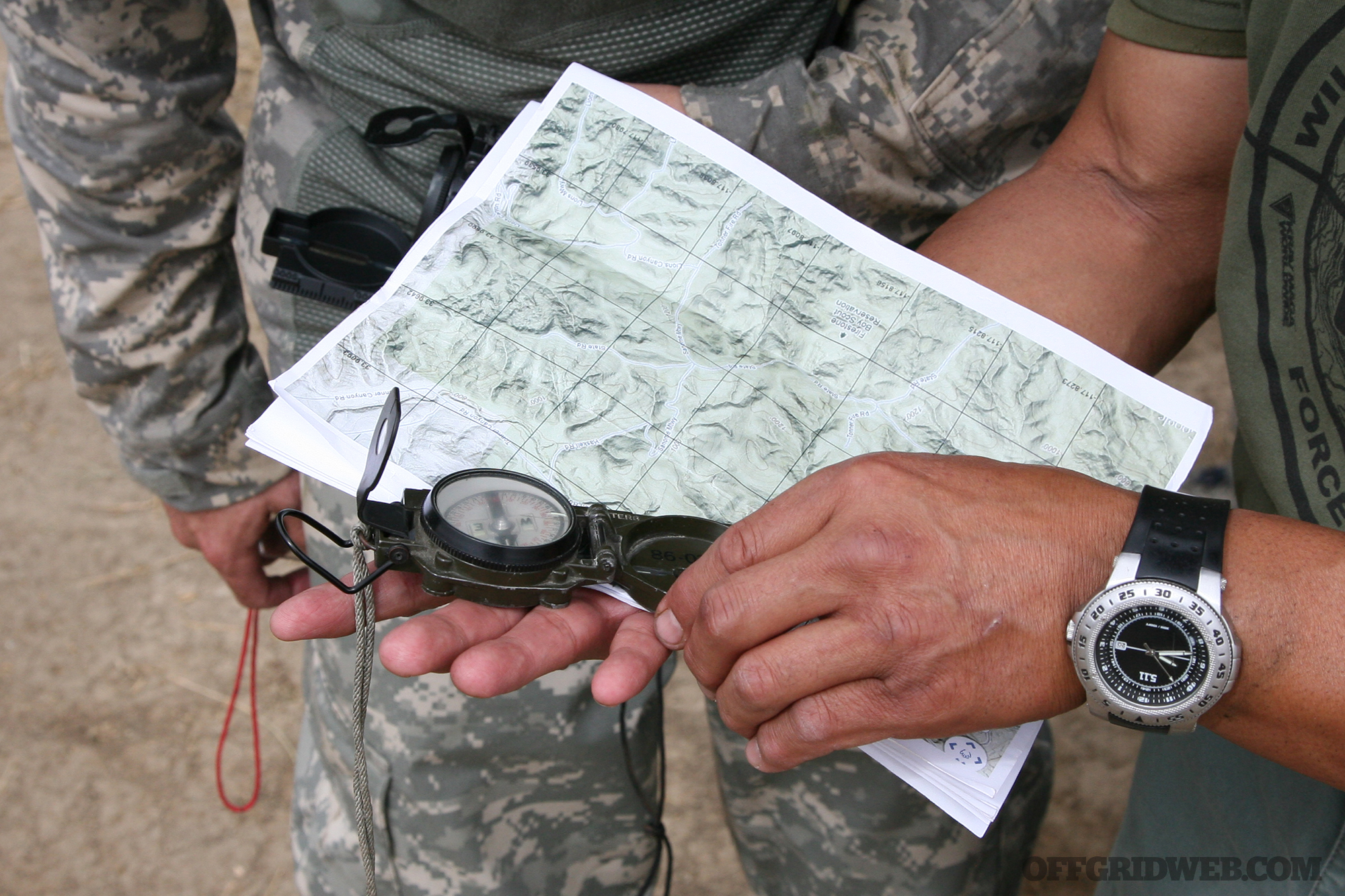
With sufficient training and knowledge, it’s possible to rely on primitive methods of orienteering and communication, such as celestial navigation and smoke signals. But we’ve come a long way since the days when those were the only options. Technology has made our lives much easier, so we might as well make use of it while it’s available. Obviously, if the grid goes down and electronics become useless, we can fall back on primitive methods — until then, it’s wise to use the best tech available.
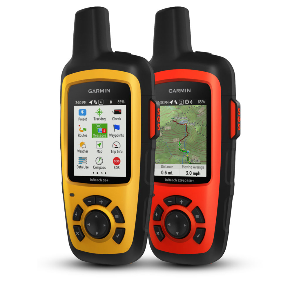
Early this year, Garmin announced the release of a new inReach line of devices which combine GPS navigation and two-way satellite communication. The Garmin inReach SE+ and inReach Explorer+ are the first Garmin devices with these capabilities, some of which were acquired through the company’s purchase of DeLorme in 2016. Both devices have Pole-to-Pole global Iridium satellite coverage for two-way text messaging and SOS alerting anywhere in the world.
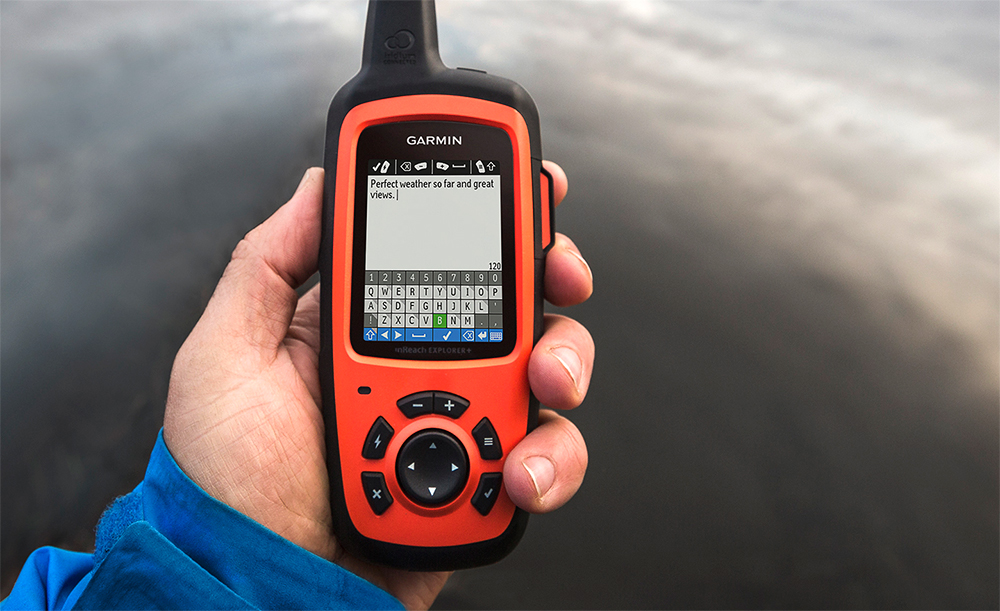
Much like a smartphone, the Garmin inReach devices can send text messages to and receive replies from any cell phone number or email address. But, thanks to the network of 66 Iridium satellites, these devices can do so from anywhere in the world with 100 percent seamless coverage. Accessing this satellite network requires a monthly subscription, which ranges from $12 to $100 per month depending on usage level.
If something goes wrong, there’s also an interactive SOS feature — here’s how it works:
- You press the SOS button to send an emergency alert.
- The GEOS 24/7 search and rescue monitoring center responds quickly, confirming that help has been called.
- You describe your emergency so responders know whom and what to send.
- Responders advise you when to expect assistance — and suggest potentially life-saving actions to take in the meantime.
- You communicate with friends and family, letting them know the situation and where to contact the rescue team.
- Help arrives. You’re able to coordinate any logistics or medical care that may be needed upon your return.

Both the inReach models also include a built-in GPS for location tracking and basic navigation. For $50 more, the Explorer+ adds pre-loaded topographic maps, as well as a compass, barometric altimeter, and accelerometer for more sophisticated navigation capabilities. Both models offer location sharing, so your friends and family can follow your progress from a computer or smartphone if you enable the feature. You can even embed the GPS progress tracker on your Facebook page or blog.
The Garmin inReach SE+ is available at an MSRP of $400, and the inReach Explorer+ is $450. For more information, go to Explore.Garmin.com.