In This Article
In this era of GPS satellites and smartphone apps, it’s easy to forget about the navigational technology that preceded these modern conveniences. Thousands of years ago, our ancestors didn’t have the luxury of Google Maps. Early magnetic compasses first saw use in the 11th century, but these were only temporarily magnetized using a lodestone and were far too large to be considered portable. The pocket-sized, liquid-filled, mass-produced compasses we know today have been around for less than 100 years.
So, how did our forefathers figure out where they were going in the days before GPS and reliable magnetic compasses? They used celestial navigation — techniques for determining position based on the location of the sun, moon, planets, and stars.
You may think that these techniques are obsolete today, but every prepared individual knows that it’s wise to develop knowledge of alternative navigation methods in case Plan A (or B, or C) isn’t an option. Even the U.S. Navy has reintroduced celestial navigation to its training programs after briefly phasing it out. In a SHTF scenario, it can be a very effective means of getting your bearings.
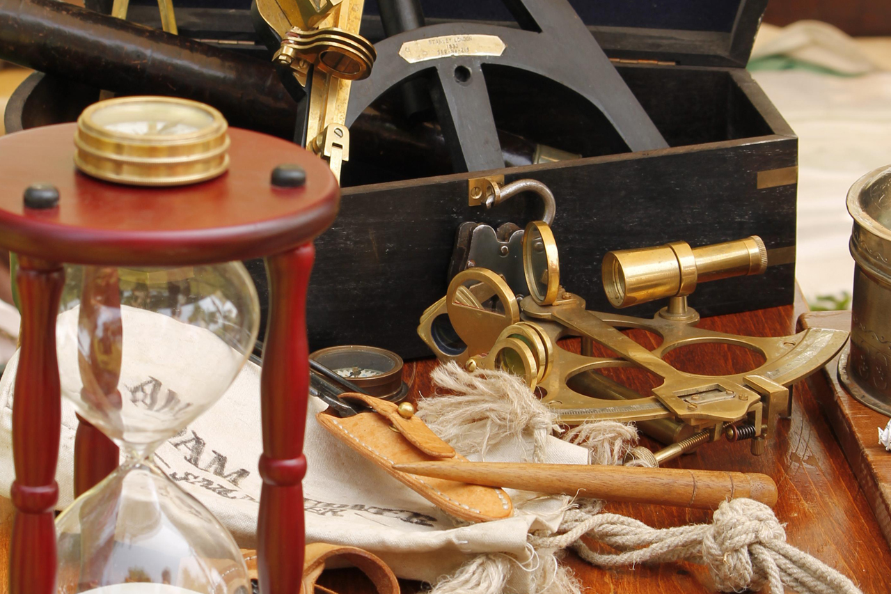
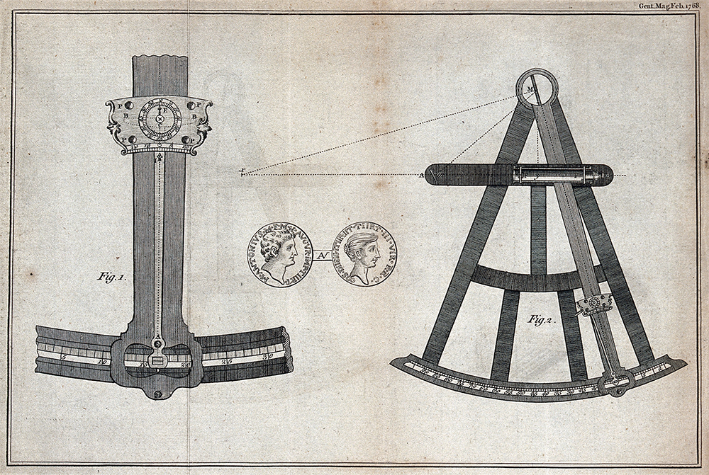
One of the most straightforward forms of celestial navigation relies on the sun. You’ve probably heard of rudimentary solar navigation techniques such as the shadow stick method or the analog watch method, but depending on your geographic location and the season, these improvised techniques have the potential to be inaccurate or entirely ineffective. This is why our seafaring ancestors developed more precise mechanical instruments such as the kamal, astrolabe, octant, and sextant — but we’d be willing to bet you don’t have any of those stashed in your bug-out bag.
Fortunately, it’s still possible to learn solar navigation without expensive and fragile tools or in-depth knowledge of spherical trigonometry.
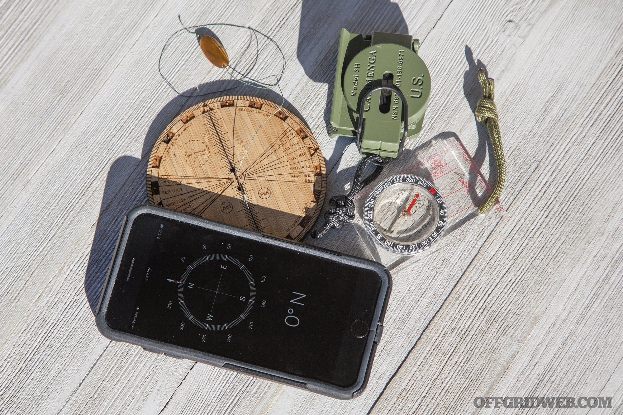
African Sun Compass
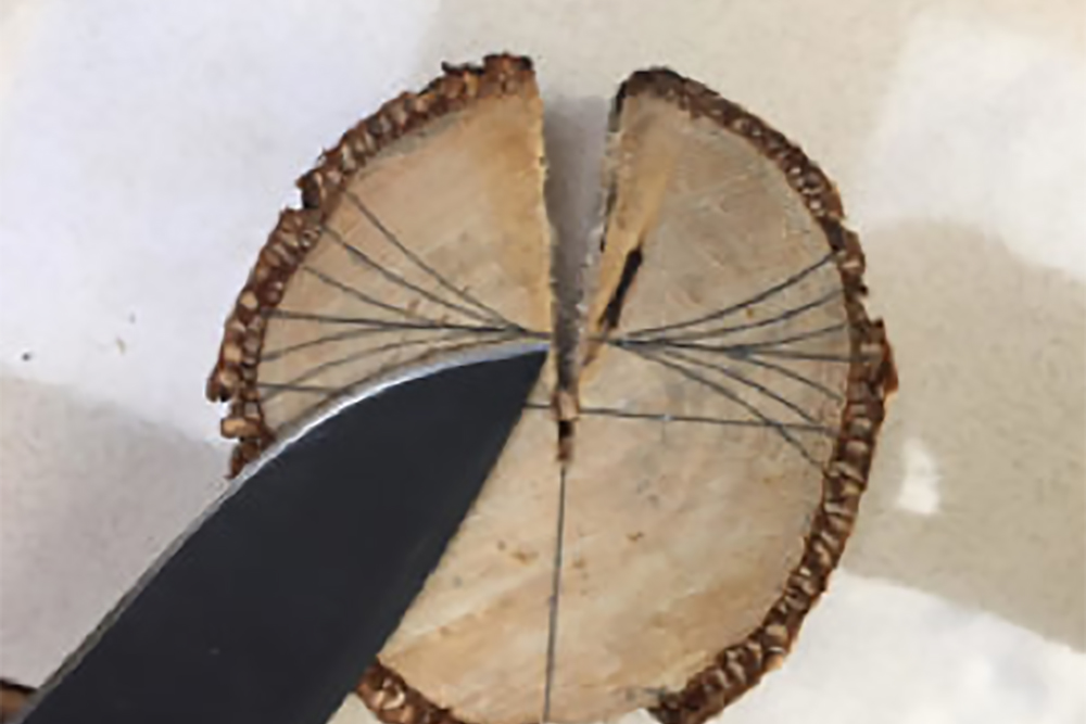
The African Sun Compass was developed as a durable, lightweight, pocket-sized tool for solar navigation. Its creator, Timm Irvine-Smith, is a South African who loves traveling the world with his wife Melina. Based on his knowledge of the imprecise shadow stick method and other ancient devices, such as the Ottomani Compass and the Viking Sun Stone, Irvine-Smith set out to make a simplified device that could provide orientation, latitude, and longitude. His first prototype was a simple piece of wood with lines drawn on it:
He wrote, “Eventually while traversing Switzerland I managed to determine my position (Latitude & Longitude) to within 27 km with the version on this page. I then knew that I was onto something.”
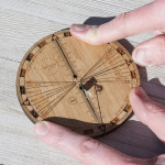
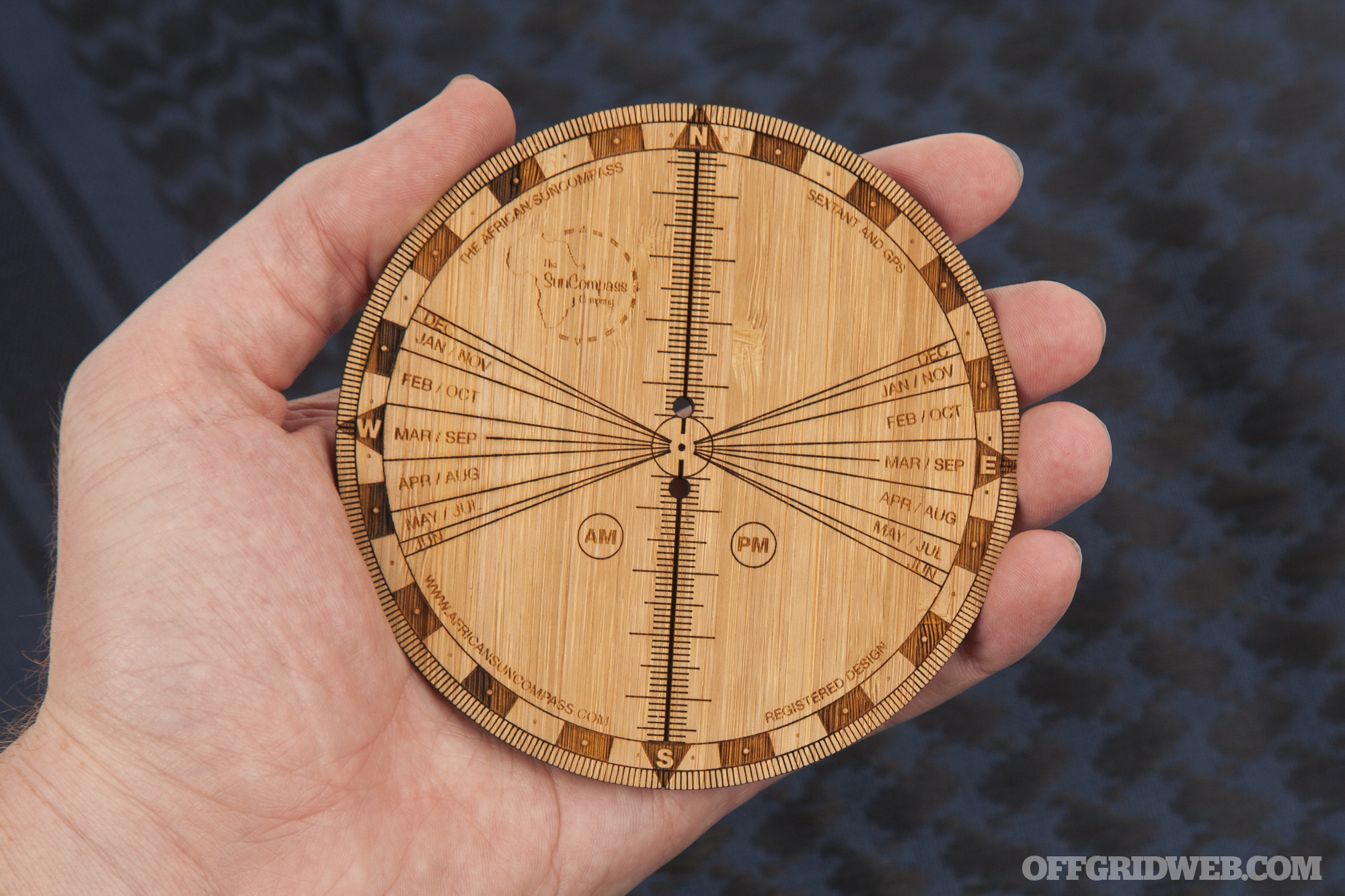
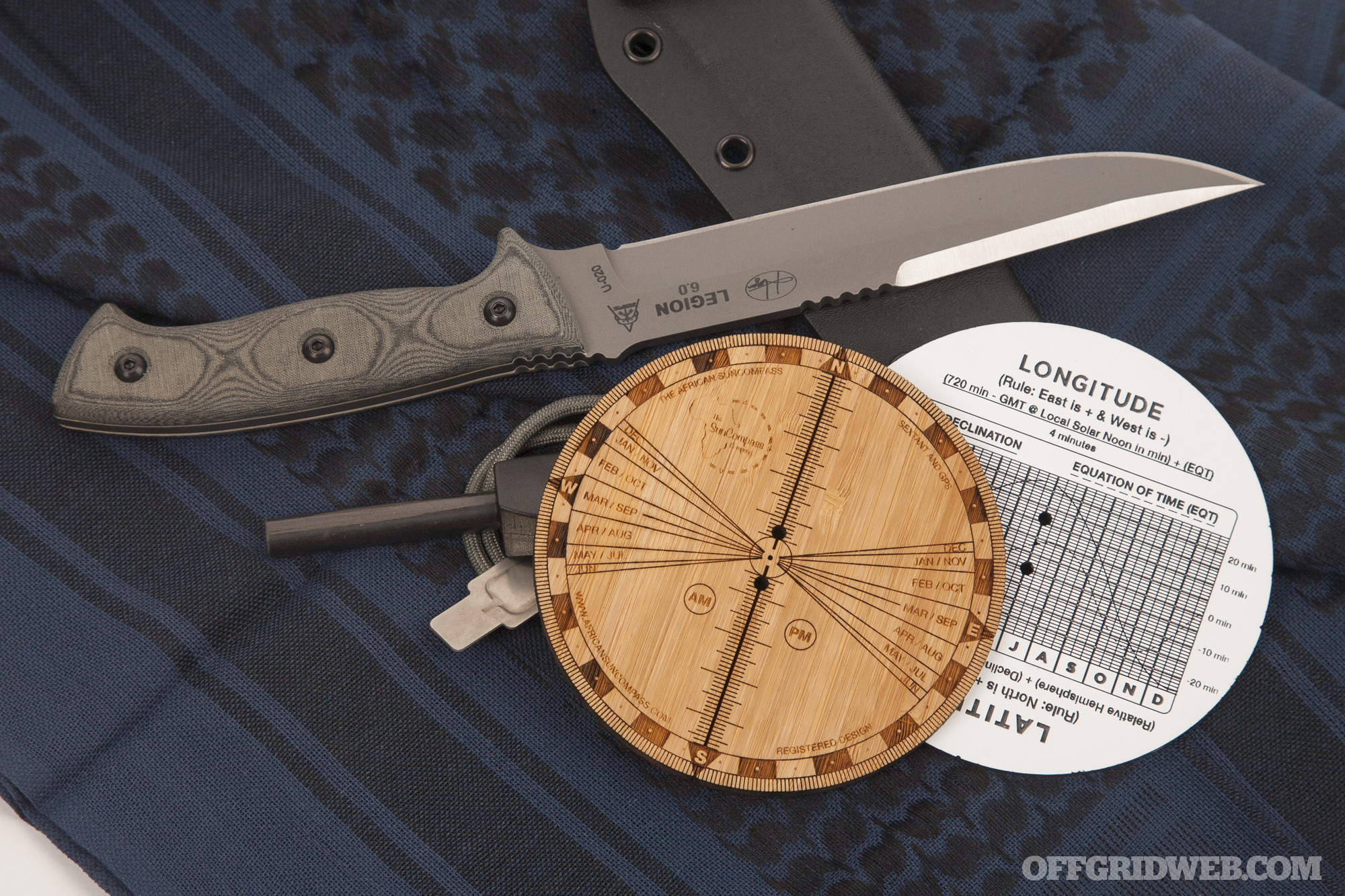
This evolved into the African Sun Compass, which is available in either white TroPly polymer or natural bamboo. The markings are deeply laser-etched on each side of the 0.2-inch-thick disc. Each Sun Compass includes the following parts:
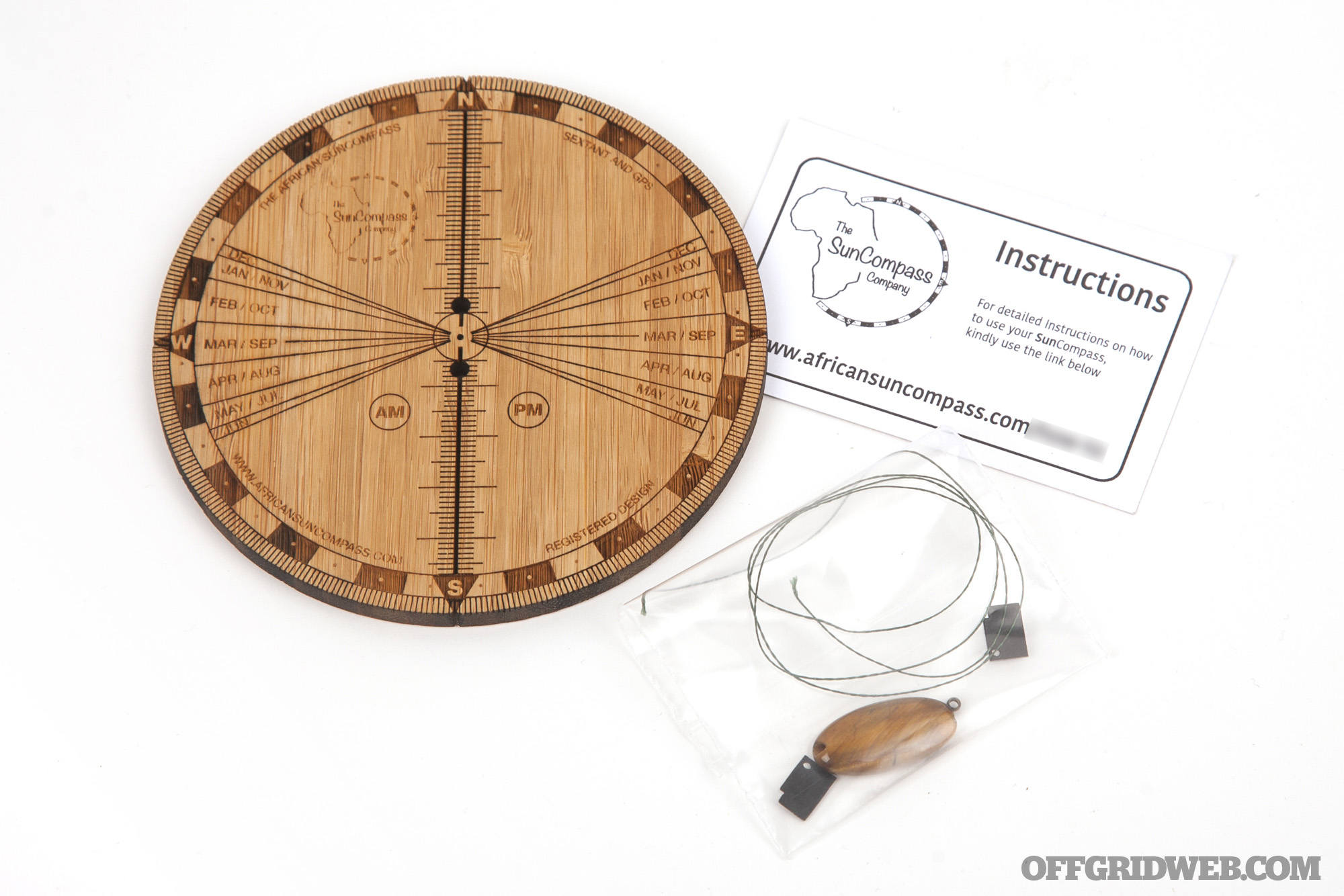
- Compass disc
- Plumb line
- Gnomon
- Pendant weight
- Copper retention ring
- Card with web link for detailed instructions
Assembly and Calibration
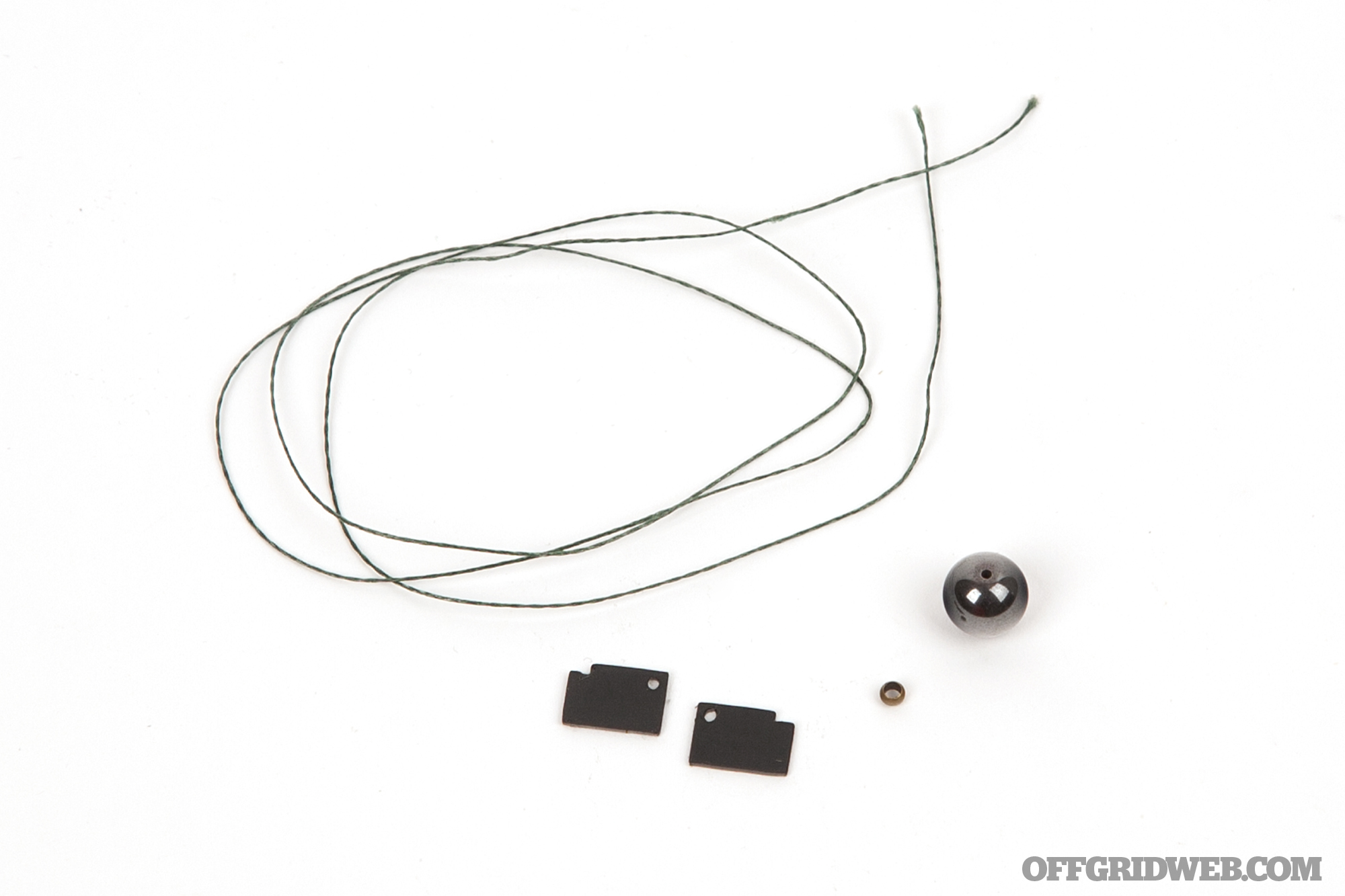
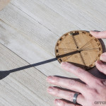
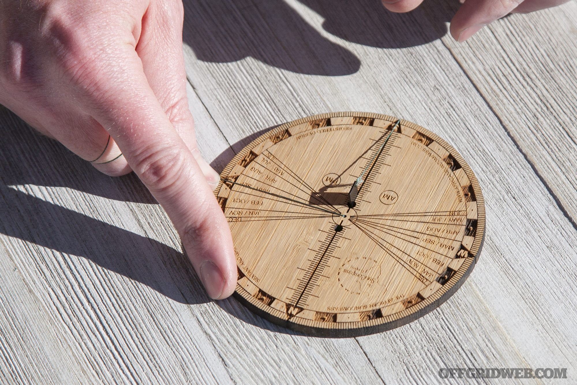
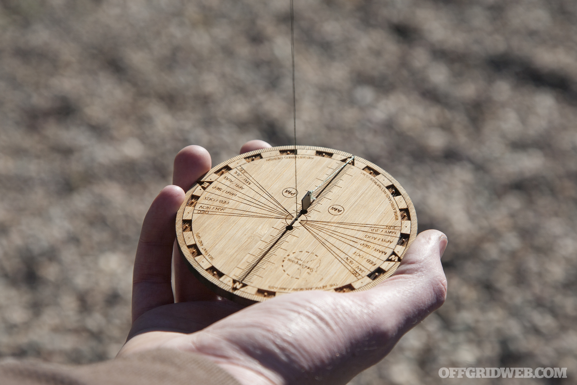
Before using the Sun Compass, you’ll need to do some quick assembly. Run the plumb line through the hole in the center of the disc. On the side with the cardinal directions, pass this string through the pendant weight (a metal ball for TroPly models, or a stone for bamboo models), and tie it tightly around the tiny copper ring to retain the weight. On the other end, tie the string to the hole in the gnomon. This small metal chip will be inserted into the groove that runs between North and South.
To calibrate your Sun Compass so it reads True North, you’ll need to follow the steps shown in the instructions.
Note: If you’re using the sun compass in the afternoon, you’ll need to start with the stick shadow cast from West to the center hole (as pictured in steps 1-8 above). If you’re using it in the morning, you’ll need to start with the shadow cast from East to the center hole. The “AM” and “PM” markings on the face refer to the side the plumb line must be placed on, not the side the shadow starts on — the instructions aren’t entirely clear about this at first glance.
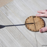
Above: Pointing the stick shadow at the center hole, tracking the shadow’s new position after 5 minutes, and aligning the gnomon shadow with the plumb line at the East marker.
Once your Sun Compass is calibrated, make a note of the exact gnomon position using the hash marks along the groove. You’ll need to go through these steps to re-calibrate it once a week to retain maximum accuracy.
Finding North
To orient the compass to True North, you’ll need to start by checking the declination figure on the back side of the Sun Compass. We tested the compass on February 7th, which gives a declination of -16. We were using the compass in the afternoon, so we started at East and moved 16 degrees towards “Feb/Oct” on the compass face.
With the gnomon calibrated and the corner of its shadow touching the plumb line, you’ll find True North.
The Sun Compass is capable of doing far more than simply pointing out the cardinal directions. It can also help you triangulate your position on a map, chart a course to a landmark, or even calculate your latitude and longitude once a day at noon.
Triangulation
To triangulate your current position on a map, you’ll need to find North, then follow the steps pictured in the instructions to find your location in relation to three visible landmarks (mountain peaks, islands, etc.). It’s worth mentioning that the instructions don’t have a step 7 — this numbering error is present in the original documentation on the Sun Compass web site.
A similar process can be used to chart a course to a landmark and walk a bearing in that direction. Instructions are also provided for this purpose.
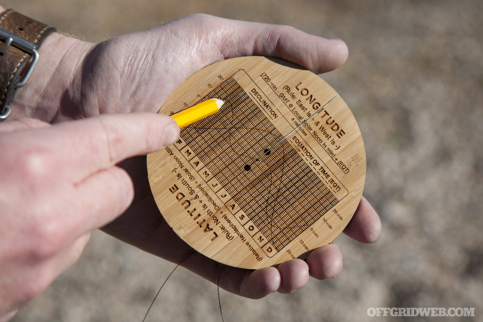
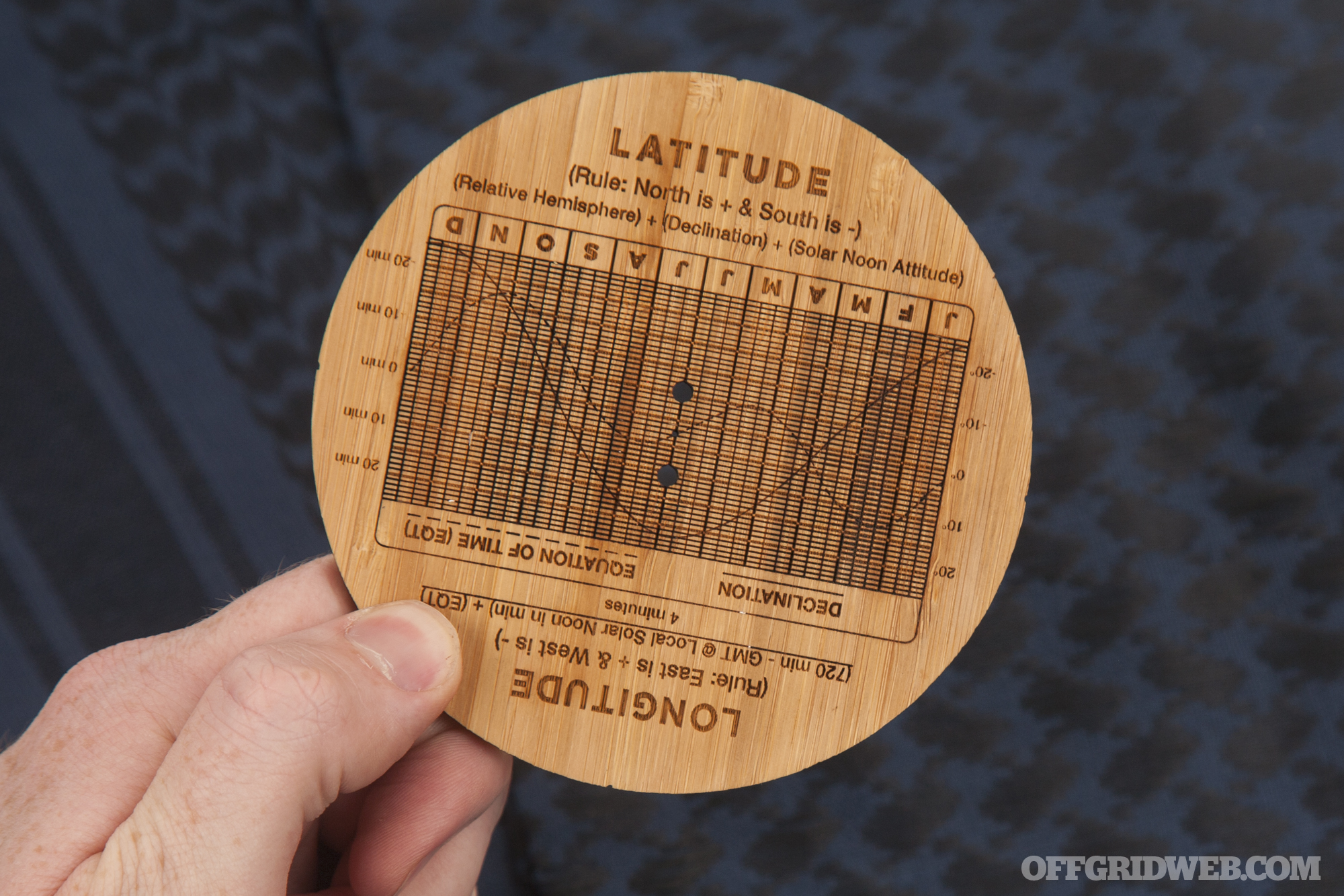
Daily GPS Fix
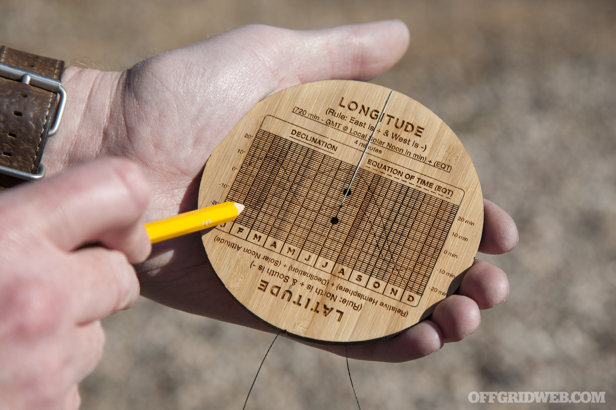
With the Sun Compass, you can calculate your latitude and longitude once per day at Local Solar Noon. This is a complex process, and is explained in detail in the instruction PDF file on the African Sun Compass web site. For the sake of brevity, we’ll summarize the process below:
- Point the compass North and wait for Local Solar Noon, when the gnomon shadow aligns exactly with the N/S line.
- Determine Greenwich Mean Time (GMT) and how much you’re ahead or behind of it.
- Use the dashed “Equation of Time” line on the back of the Sun Compass to establish the date-based deviation figure.
- Calculate longitude: (720 minutes – GMT @Local Solar Noon in minutes) + (Equation of Time) / 4 minutes
- Measure sun angle by hanging the pendant weight vertically as a pendulum.
- Calculate latitude: (Relative Hemisphere*) + (Declination**) + (Sun Angle)
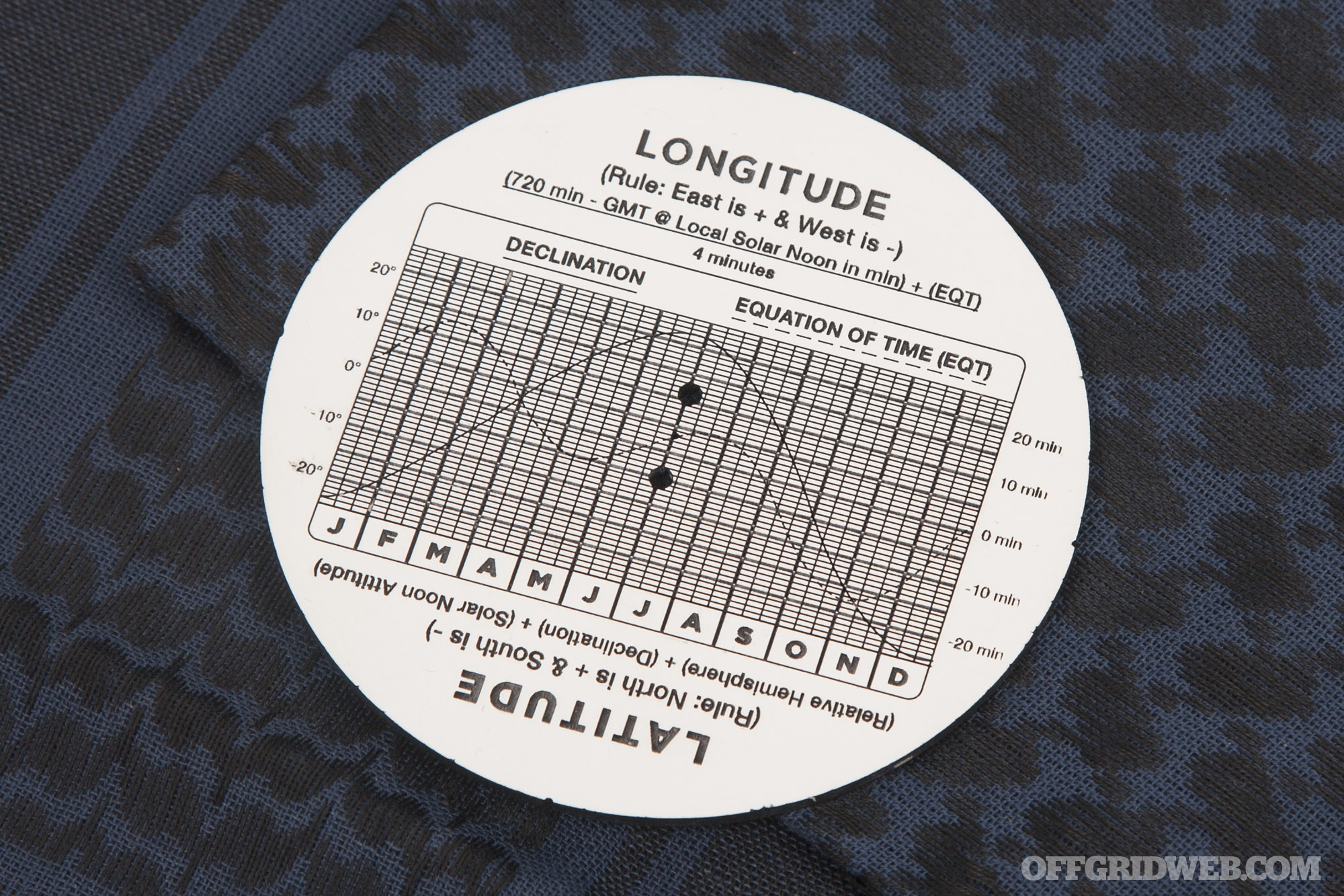
* Either -90 or +90 depending on whether the gnomon is placed in the North or South side of the center groove.
** Obtained from cross-referencing the date with the solid line on the back of the Sun Compass.
Our Experience with the Sun Compass
We did some hands-on testing with the Sun Compass on a clear and sunny February day in Arizona. Setting up the Sun Compass for the first time was easy enough, and the tightly-knotted string keeps the gnomon and pendant weight from getting lost in transit. If you do lose or damage the gnomon, a spare is included.
Calibration was fairly straightforward, although we got started on the wrong side due to confusion about the previously-mentioned AM/PM issue. After flipping the dial 180 degrees, it took about 3 minutes to calibrate the compass once the stick’s shadow moved sufficiently. After calibration, we looked up our declination (16 degrees) and rotated the disc until the gnomon shadow told us we reached True North. Again, this step is dependent on whether it’s morning or afternoon, so be sure your plumb line is on the correct side.
Triangulation and setting a bearing was more complex. Aiming with the plumb line is much like shooting an azimuth with the sight wire of a lensatic compass. However, keeping the Sun Compass perfectly level and the plumb line at 90 degrees throughout the steps isn’t easy, and deviations can lead to less accurate readings. On the upside, you don’t need to worry about memorizing or looking up magnetic declination like you would with a typical compass.
We attempted the daily GPS fix process, but to say it’s daunting for a first-timer would be an understatement. We found ourselves repeatedly re-reading the instructions and scratching our heads about converting Local Solar Noon to GMT to minutes. Since we didn’t have Arizona’s GMT differential memorized we had to Google it — it’s GMT-7, meaning we needed to add 7 hours to local time to reach GMT. If your area observes daylight savings time, you’ll also need to factor that in.
Local Solar Noon occurred at 12:41, which is 7:41 GMT, which is 461 minutes. The chart on the back of the compass indicated our Equation of Time value of +13 minutes. Plugging it into the formula, we got the following result:
(720 minutes – 461 minutes) + (13 minutes) / 4 minutes = 68 degrees
Evidently we did something wrong, since the actual longitude at our location was 111.606 degrees West. Going back over the numbers, we realized our error: the calculation must be done with time in the 24-hour format. This seems obvious in retrospect, but isn’t mentioned in the instructions or the provided example, so we overlooked it in our first calculation. The correct longitude formula would be:
(720 minutes – 1,181 minutes) + (13 minutes) / 4 minutes = -112 degrees
Recalling the “East is + and West is -” reminder on the compass, we get a longitude of 112 degrees West. This seems pretty close to 111.606, but more on that later.
To determine latitude with the sun compass, you have to measure the angle of the sun, another substantial task that requires more instructions and pendulum-dangling. Then you need to check declination on the chart and calculate the result of a second formula. Here’s what ours worked out to:
(90 degrees relative hemisphere) + (-16 degrees declination) + (-41 degrees sun angle) = 33 degrees
This positive value indicates 33 degrees North. After plugging our actual location into an online GPS distance calculator, the difference between our actual GPS coordinates (pulled from a GPS app with 7 decimal places) and the Sun Compass’s result worked out to an error of roughly 26.1 miles. That’s within the device’s claimed accuracy range of 50 kilometers (31 miles).
Conclusions
The African Sun Compass is a surprisingly capable device. It’s a disc of bamboo with a string through it — no electronics, GPS chip, or even a measly magnet — yet it still manages to act as a self-contained navigational system that works almost anywhere the sun is visible. We were able to determine True North, chart courses to landmarks, and even calculate our latitude and longitude with reasonable accuracy. That’s a seriously impressive feat.
However, we approach all survival tools from a practical standpoint, and this is where the African Sun Compass begins to show its flaws. Would we rely on it in a life-and-death situation? Yes, but only if no modern navigational tools were available. We say this for the following reasons:
Complexity. The Sun Compass is far from idiot-proof. While the instructions are helpful and detailed, you’d certainly struggle to use this tool without reading (and re-reading, and re-re-reading) those instructions. Also, the instructions are only offered in digital form. You’ll need to read them on a computer/smartphone, or print the PDF files yourself. A portable pocket-sized instruction booklet would’ve been a godsend.
As we learned firsthand, there are many points at which values can be misread or miscalculated, potentially throwing off your orientation or position. We did our best to remain patient while using the compass, but it definitely tried that patience at times — we can only imagine how frustrating it would be in a true survival situation, suffering from hypothermia, dehydration, or physical injury.
Reliability. Unlike a magnetic compass or GPS, the Sun Compass can only be used outdoors during the day and in reasonably clear weather. If fog, clouds, or a dense forest canopy obscures the sun, you lose your ability to navigate.
Taking readings requires you to stop moving, pull the line taut, measure a shadow, and in some cases do some mental algebra. The compass’s use changes from morning to afternoon, and it also requires re-calibration at least once a week to maintain accuracy.
Geographic position is also an important variable. If you live in an area that ever gets less than 7 hours of sun per day, such as Alaska, northern Canada, or Scandinavia, the Sun Compass will be rendered ineffective during winter months. And if you’re in the tropics — such as Central America, Southeast Asia, or (ironically) most of Africa — your relative solar hemisphere may change throughout the year, changing how the compass must be used.
Cost. The Sun Compass is currently available for 899 South African Rand, which currently equates to about $66 USD. You can get a very respectable Silva or Suunto magnetic compass for that kind of money — or several cheaper compasses, if you want backup options.
That said, the African Sun Compass is a great tool to have in your toolbox, and a fun challenge to undertake. It teaches you to truly delve into precise solar navigation, rather than shoving a stick in the ground and using it to guesstimate where North is. If you invest the time it takes to master this tool, you’ll become a more knowledgeable and prepared person — even if you still rely on your GPS device or magnetic compass in 99.9% of situations.
For more information on the African Sun Compass, go to AfricanSunCompass.com.
UPDATE 2/18/19: After reading our article, Timm reached out to thank us for the feedback, and let us know he’s been making revisions to the Sun Compass to address some of our concerns. Specifically, he has made the following changes:
- 24 hour time format is now mentioned in the instructions
- The AM / PM issue is solved in the front face design
- The numbering on the navigation instructions has been fixed to have the seventh step and not jump to eight
We’re glad to hear that the Sun Compass is improving, and we commend Timm for being so open to user feedback.
