Accurate navigation is key to any bug-out plan, and in this age of easy-to-use GPS devices, it’s easy to become over-reliant on digital maps. During a major disaster, GPS services will likely be inaccessible unless the maps are saved locally on your phone or PC. Even then, the lack of a reliable power source can make reading those saved maps difficult or impossible. In these situations, physical paper maps are an invaluable resource for survival.

In years past, obtaining a printed map of your area often meant purchasing said map from a local outdoor gear store. While this was relatively convenient, it was also costly, and map quality varies substantially depending on the source. Some of the most accurate and reliable maps come from the U.S. Geological Survey, or USGS, but physical copies of these maps could cost in excess of $10 per sheet.
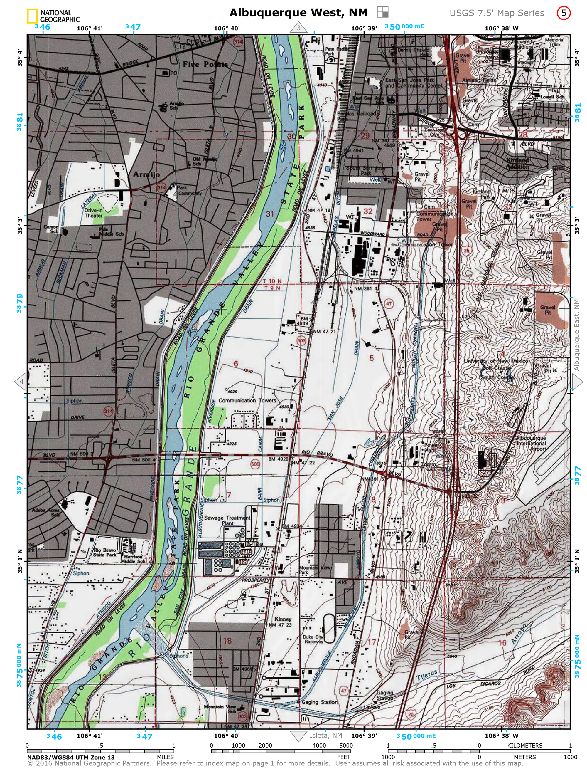
Fortunately, National Geographic has partnered with USGS to make these maps available to the public, free of charge. The new NatGeo Topo Maps web site offers an easy-to-use interactive map, where users can enter an address or zoom to a local area to find the appropriate map. Each region then shows a red callout symbol, which opens a 5-page PDF document when clicked. This PDF can be saved to your computer, emailed, or printed at home.
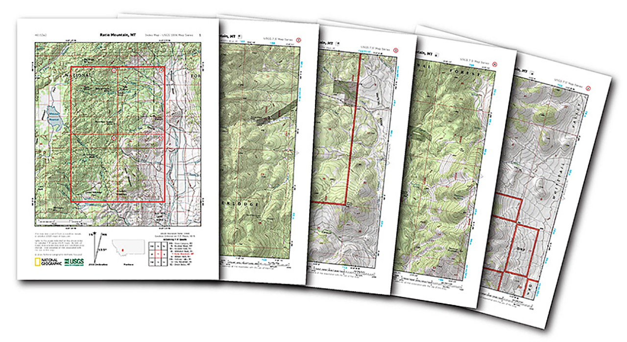
Whether you have an existing bug-out plan in place, or you simply want a reliable backup map to store in your vehicle or backpack, these USGS topographic maps are an excellent resource. They show local roads, highways, bodies of water, landmarks, and changes in elevation in an easily-readable format. If you print these out at home and have them laminated at a local office supply store, you’ll have a set of accurate maps that can remain useful for decades—and they’ll never run out of batteries, either.
To download maps or learn more, visit natgeomaps.com/trail-maps/pdf-quads.
