Anyone who has sat through a seemingly-never-ending math class can tell you that numerical data can be boring. Next to images and video, numbers and graphs often seem uninteresting. However, there are some cases when this data can paint a clear picture that no camera could accurately capture, like probes measuring the inhospitable atmosphere on Mars, or a seismograph showing the progression of a massive earthquake. In these cases, data is anything but boring.
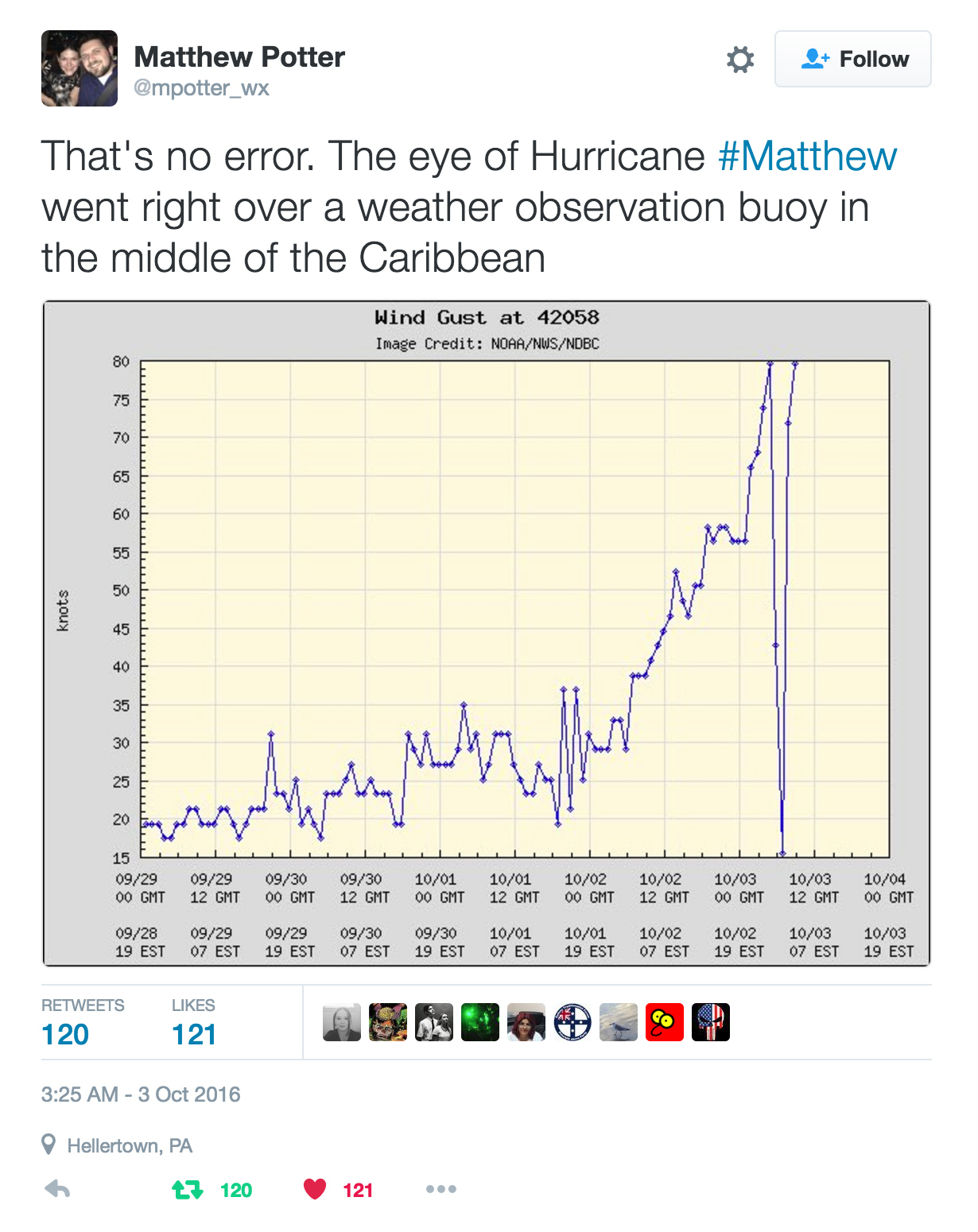
This week, we found an incredible set of data from a lone weather buoy in the middle of the Caribbean. This buoy reports data on waves, wind, water temperature, and barometric pressure to the National Oceanic and Atmospheric Administration (NOAA). On Monday, October 3rd, the buoy was passed directly over by the central eye of Hurricane Matthew, and it illustrates the raw power of this storm. In the screenshot above, forensic meteorologist Matthew Potter confirms the validity of this data.
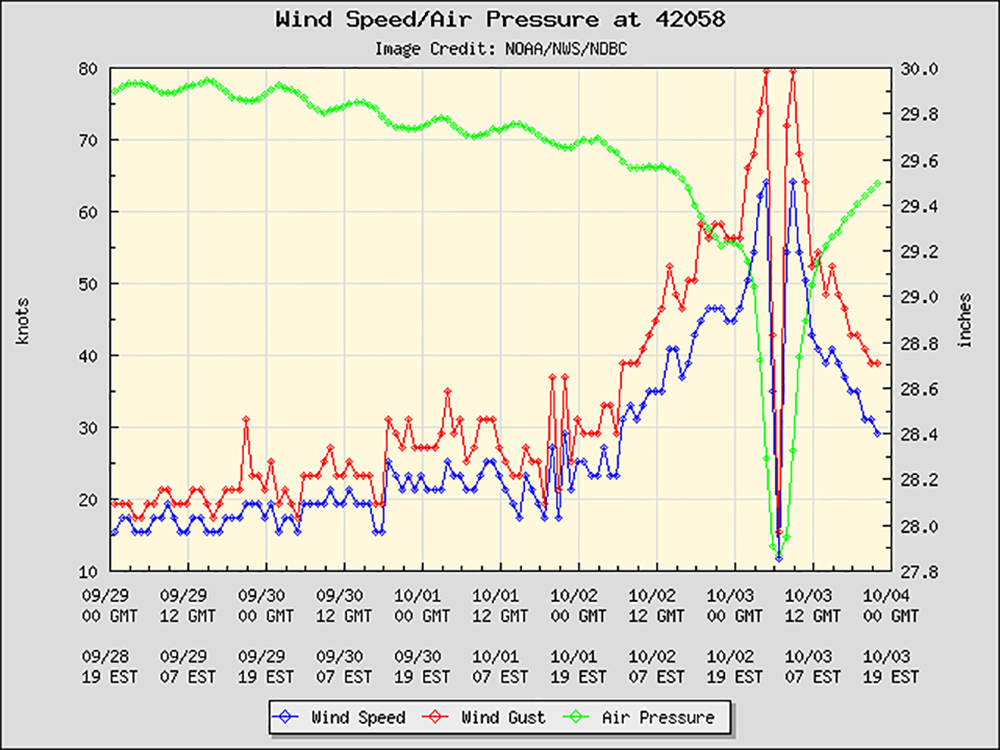
The chart above shows wind speed rising and barometric pressure falling exponentially as Hurricane Matthew’s center approaches the buoy. The gusts build to an immense 80 knots—that’s 92 miles per hour. Suddenly, winds drop to a dead calm, and almost immediately resume hammering the buoy. It must have been quite the experience.
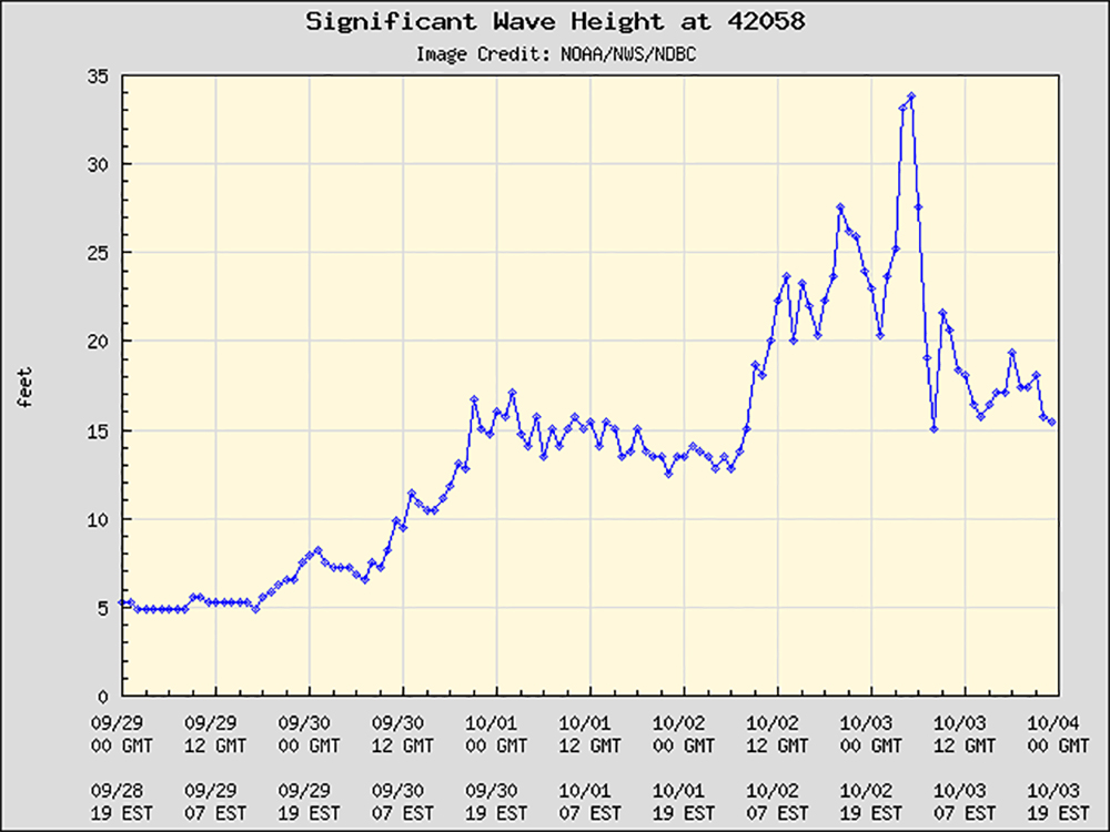
The above wave height graph paints an equally incredible picture. Swells reached nearly 35 feet, enough to sink all but the toughest boats. To put this into perspective, here’s a clip from Discovery Channel’s Deadliest Catch showing a crabbing boat hit by a 35-foot wave:
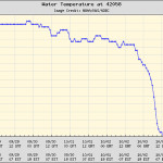
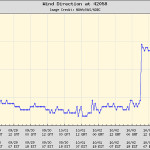
Seawater temperature and wind direction (seen below) also mirror these drastic changes. It’s a rarely-seen glimpse into the conditions at the center of a powerful hurricane, one which would continue to grow stronger and reach a peak diameter of 70 miles wide. It’s also moving rapidly toward Florida, Georgia, and the Carolinas, and is expected to make landfall in the next few days.
For more information on the storm’s path, check out this multi-layer storm tracking map with USNG grid overlay. The drop-down menu in the top right corner provides more display options. (Thanks to contributor Andy Schrader for the link.) You can also follow FEMA news releases for more details on evacuation, if you reside in a region that’s predicted to be hit by Hurricane Matthew, or check out our previous articles on hurricane preparedness.
